 Pura Osa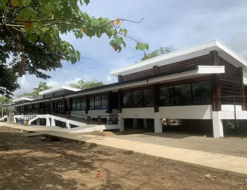
Palmar and Puerto Cortés at a glance
| Fact | Detail |
|---|---|
| Where | Both banks of the Térraba River, on the way between the Costa Ballena and the south of the peninsula |
| Districts | Palmar (Norte and Sur) and Puerto Cortés, the two most populated of the six districts of Osa |
| From San José | About 5–6 hours by car via the Costanera Sur (Route 34); Tracopa bus; Sansa flight to Palmar Sur |
| To Sierpe | About 15 km from Palmar Norte, roughly 25 minutes |
| Best for | History, archaeology, birds along the river, a practical stop before the boat to Drake Bay |
| Time to allow | Half a day to one full day |
Two Palmars, one river
Palmar is not one town but two, set on opposite banks of the Térraba, the largest river basin in Costa Rica. Palmar Norte lies on the north bank and Palmar Sur on the south bank. The place was once called Palmar de los Indios, then Palmar de Castañeda, before the name Palmar Norte stuck.
| Town | What it is |
|---|---|
| Palmar Norte | North bank. The Pan-American Highway passes here, so it is the bus stop, the junction and the place to buy supplies before the south. It grew as the recreation town for banana workers. |
| Palmar Sur | South bank. The banana company’s base: landing strip, dispensary and company housing. Today: the regional airstrip (PMZ), Finca 6 and a quiet grid of old company streets. |
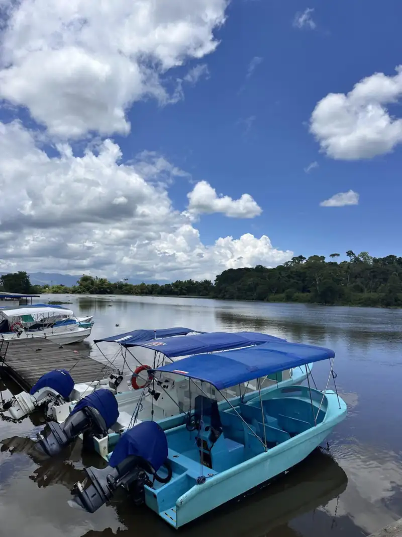
| Puerto Cortés (Cortés) | Older river port and seat of the canton. Rice, cattle and services. The historic landing, the Muñeco mountains and the Grijalba-2 sphere site are here. |
Palmar Sur: bananas, an airstrip and the spheres
In the mid-1930s the banana company left the Caribbean, where plagues had hit its plantations, and moved its operations to the south Pacific. Palmar Sur became its base. It built a landing strip, a dispensary and housing for its workers, and many of those buildings, plus the church and recreation spaces, still shape the town. The company closed its southern operations in 1983–84, ending more than three thousand jobs, and the lands were slowly turned to African palm and other crops. The longer story is in the history of Osa.
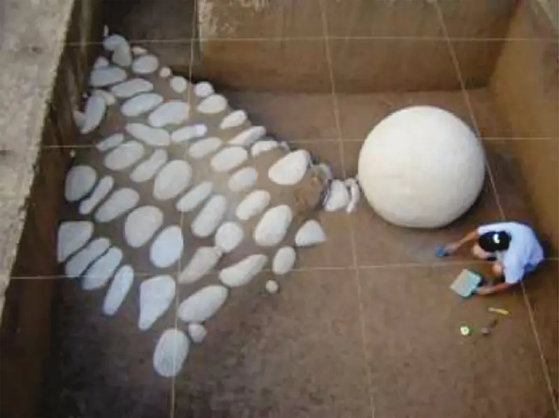
The same cleared delta is where the stone spheres began to appear. They were carved about a thousand years ago by the chiefdoms of the Diquís, and the best place to see them is Finca 6, an easy half-day stop. The airstrip, today called Palmar Sur (PMZ), is served by Sansa from San José, which makes it the quickest way into this part of Osa.
The four UNESCO sites of the delta
UNESCO recognized the stone-sphere settlements of the Diquís in 2014 as a group of four sites. Only one is set up for regular visits.
| Site | Where | Visiting |
|---|---|---|
| Finca 6 | Palmar Sur | Open to visitors: museum, trails, spheres where they were found. Full guide |
| Batambal | Palmar area | Part of the UNESCO group. Not set up for regular visits. |
| El Silencio | Palmar area | Part of the UNESCO group. Not set up for regular visits. |
| Grijalba-2 | Cortés area | Part of the UNESCO group, in the Cortés area. Ask locally before trying to visit. |
Puerto Cortés: the river port that became a town
Puerto Cortés began around 1912–1915 as a hamlet called El Pozo, settled by colonists from several countries who grew rice and raised cattle. In 1934 it was renamed in honor of the president León Cortés Castro, and in 1957 it was declared a city. When the banana company settled in the south, the river landing was the entry point to the whole zone by water from Puntarenas, and the town buzzed with a busy pier, cinemas and traders.
Then the roads arrived. From the 1960s, highways replaced barges and trains, and the periodic floods of the Térraba pushed the town gradually toward higher ground. Many wooden buildings disappeared, which is why Puerto Cortés is sometimes described as a melancholic town. Today it is the seat of the canton, with the municipality, schools and everyday services, and a quiet riverfront that rewards a slow visit.
What to see and do
- The Embarcadero. The historic river landing, still used by artisanal and sport fishers, with older buildings tied to fishing and shellfish. Canoeing and sport fishing through the estuaries and mangroves start from here. A project called “De Puerto a Puerto” aims to bring back the river route that links the town with Sierpe and Puerto Jiménez.
- Street murals. Restored houses are painted with scenes of local history, banana barges and wildlife.
- The Muñeco mountains. North of town, good for hiking or mountain biking, with views of forest and of the mouth of the Térraba. Go with someone local and start early.
- The Térraba–Sierpe wetland. The delta and mangroves are protected as a Ramsar wetland. The classic way in is a boat tour from Sierpe: see the mangrove tours.
- Beaches nearby. The Pacific coast of the district includes Ojochal, with its sea caves at Playa Ventanas.
Practical tips
| Topic | What to know |
|---|---|
| Getting there | Car (Costanera Sur, 5–6 h from San José), Tracopa bus to Palmar Norte, or Sansa to Palmar Sur. See Plan your trip and renting a 4x4. |
| Getting around | Palmar Norte, Palmar Sur and Cortés are a short drive apart; a taxi or your own car makes a half-day loop easy. |
| Rainy season | The Térraba floods in the wettest months, roughly September to November. Ask about road and river conditions before you go. |
| Where to sleep | Most travelers sleep in Sierpe, Uvita or Ojochal. A night in Palmar Norte only makes sense for an early bus or flight. See where to stay. |
Events
The Festival de las Esferas, held in Palmar Sur, is the main cultural event of the area. Dates change, so we keep them in our festivals and events calendar.
Next: Osa in numbers · History of Osa · All destinations.
Frequently asked questions
What is the difference between Palmar Norte and Palmar Sur?
They are two towns on opposite banks of the Térraba River. Palmar Norte, on the north bank, is where the Pan-American Highway passes and where buses stop. Palmar Sur, on the south bank, was the banana company’s base and today has the airstrip, the Finca 6 stone-sphere site and the old company housing.
Are Cortés, Puerto Cortés and Ciudad Cortés the same place?
Yes. The town grew as a hamlet called El Pozo, took the name Puerto Cortés in 1934 and is officially Ciudad Cortés today. Locals say Cortés or Puerto Cortés, and it is the seat of the canton of Osa.
Is it worth stopping in Palmar or Puerto Cortés?
Yes, if you like history. Plan half a day: Finca 6 for the stone spheres and the banana-company streets in Palmar Sur, then the old river landing in Puerto Cortés. If you only want beaches and wildlife, you can pass through on the way to Sierpe, Drake Bay or Uvita.
How do I get to Palmar from San José?
By road it is roughly 5 to 6 hours via the Costanera Sur (Route 34) to Palmar Norte. Tracopa buses run to Palmar Norte, and Sansa flies from San José to Palmar Sur (PMZ). Schedules change, so check them before you plan around a flight or bus.
Where are the UNESCO stone-sphere sites?
The recognized group has four sites in the Diquís delta: Finca 6, Batambal and El Silencio in the Palmar area, and Grijalba-2, which lies in the Cortés area. Finca 6 is the one open to visitors with a museum and trails. See our Finca 6 guide for hours and fees.
Some links on this page are affiliate links. If you book through them, Pura Osa may earn a small commission at no extra cost to you. Recommendations are not paid. Prices, hours and schedules change; always confirm locally.